HOW SATELLITE TECHNOLOGY IS HELPING PROTECT WILDLIFE IN INDONESIA
- Apr 9, 2025
- 2 min read

In Indonesia’s tropical forests, technological innovation is ushering in a new era for wildlife conservation. What once seemed impossible is now a reality, tracking every movement of animals across jungles, oceans, and skies.
From Sumatran tigers prowling through dense vegetation to manta rays gliding beneath the waves, satellite technology is allowing us to see, understand, and protect wildlife like never before.
Why Tracking Matters
Indonesia is home to one of the richest biodiversities on the planet, but also to some of the most endangered species. Rhinos, sharks, sea turtles, and birds are under increasing pressure from habitat loss, climate change, and poaching.
To truly save animals, good intentions aren’t enough, what’s needed is data. And that’s where Argos Services comes in.
Powered by Kinéis satellite connectivity, the Argos system enables near real-time tracking
of more than 8,000 animals every month, with over 300,000 already monitored worldwide. This global network can track wildlife even in the most remote areas of Indonesia, providing essential insights that guide protection efforts where they’re needed most.
Protecting wildlife with Argos
Thanks to its advanced technology, Argos Services provides multiple benefits that make wildlife conservation and protection efforts across Indonesia more effective:
· Real-time tracking: Continuous monitoring of animal locations, even in areas without mobile network coverage.
· Behavioral alerts: Notifications that help identify unusual patterns, when an animal stops moving, changes its migration route, or enters a danger zone.
· Data-driven analysis: Mapping of critical habitats, migration corridors, and feeding areas to improve the management of protected zones.
· Support for conservation programs: Helping NGOs, researchers, and authorities protect animals in Indonesia through scientific data that drives more informed and impactful decisions.

A New Way to Protect Animals in Indonesia
Unlike traditional ground-based monitoring, satellite tracking allows scientists to observe wildlife without disturbing the most fragile ecosystems.By combining location data with satellite imagery, scientists can detect ecosystem changes, monitor deforestation, and anticipate threats to species survival.
This innovation not only helps protect animals but also transforms the way we understand conservation. From land mammals to marine life, Argos Services provides tailored solutions for every need:
• Land animals: Tracking elephants, rhinos, and tigers to study their territories and prevent poaching or human–wildlife conflicts.
• Birds: Understanding migration routes affected by deforestation and climate change.
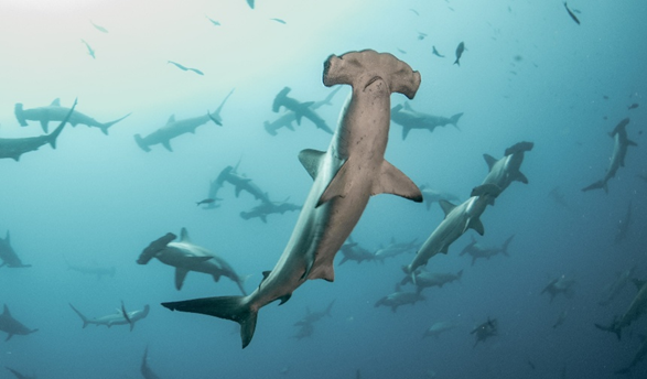
• Marine species: Monitoring whales, turtles, and sharks to define protected areas and reduce bycatch.
• Fish: Studying their movements to establish sustainable fishing seasons and preserve marine ecosystems.
The Future of conservation comes from space
Every signal sent by a transmitter represents a living being, an essential part of our planet that depends on our ability to act. By combining science and technology, Argos Services turns complex data into real-world action.
In the fight to protect wildlife in Indonesia, time and knowledge are our greatest allies.With Argos, we can save animals, safeguard ecosystems, and ensure that Indonesia’s extraordinary biodiversity continues to thrive for generations to come.